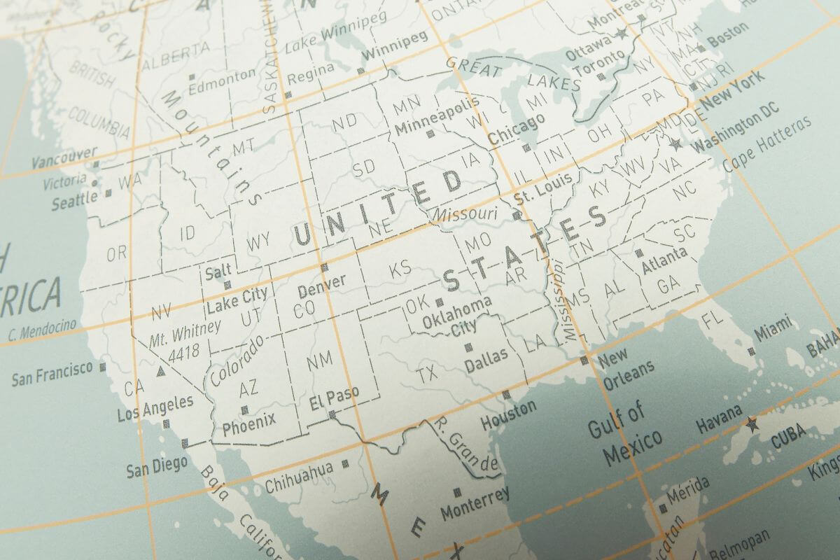
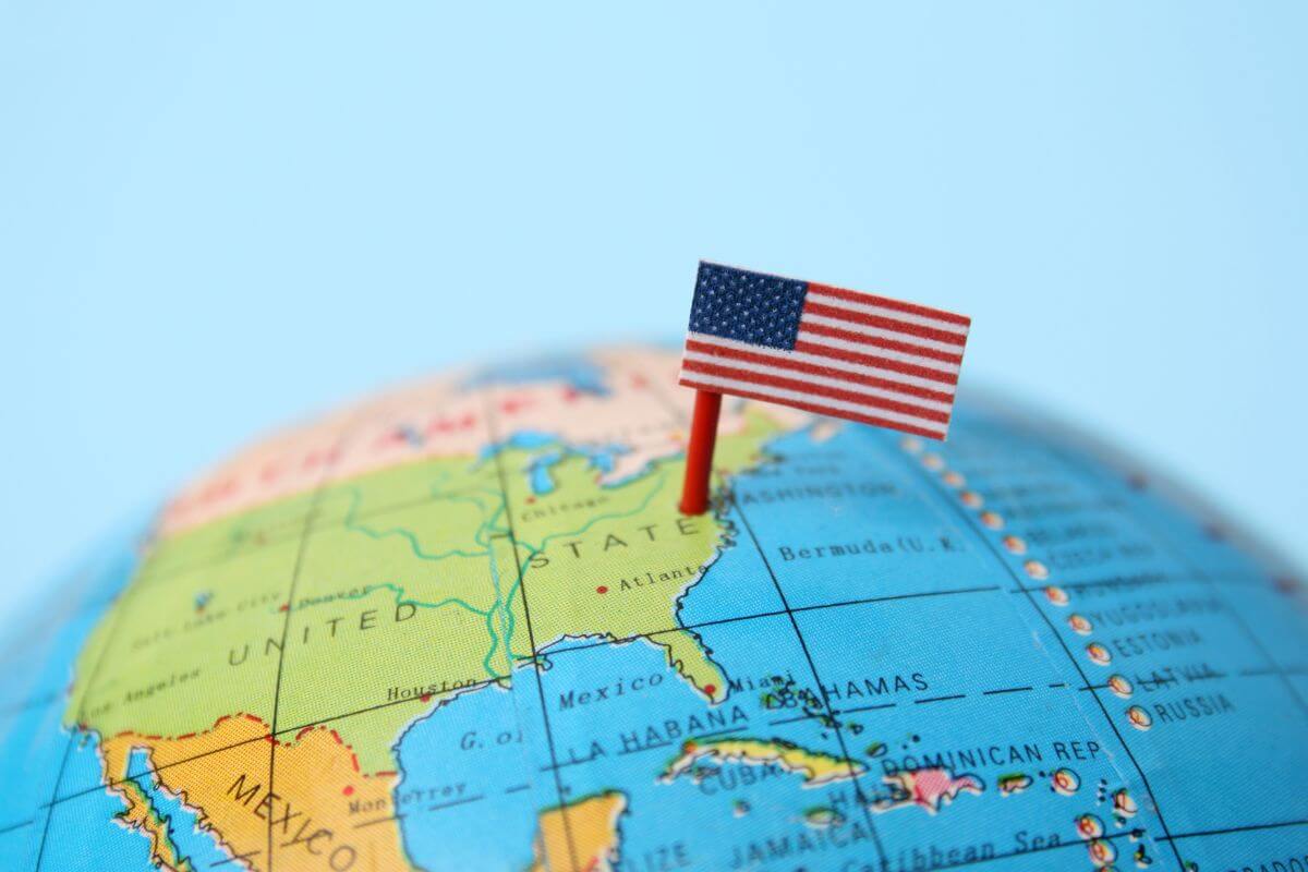
Is Montana the Biggest State in the United States? You’ve probably wondered about the vastness and magnificence of this great nation.
With its diverse landscapes and expansive territories, the United States holds many hidden wonders. When it comes to size, it’s only natural to question which state takes the crown for being the biggest.
Today, let’s embark on a journey to unravel this mystery together. With miles of land area to consider, we’ll compare Montana with other states.
We’ll explore the largest landmass, delve into the unique geography of the Gulf states, and discover how the United States stretches from north to south.
Whether you’re a curious explorer or a geography enthusiast, this article is for you.
- Related Article: Montana’s Dimensions
So, put on your explorer’s hat, and let’s dive into the breathtaking dimensions of Montana and the great landscapes spread across the United States.
Importance of Knowing a State’s Land Area

Recognizing the significance of being aware of a state’s land area becomes essential as we venture through the immense landscapes of the American continent.
This knowledge grants us invaluable perspectives on a state’s size and geographical variety, enabling us to truly grasp and savor the distinctive traits and delights each region possesses.
Outlined below are several compelling reasons highlighting the importance of acquainting ourselves with a state’s land area:
- Comparative Analysis – Knowing the land area allows for meaningful comparisons between different US states, helping to understand their relative size and geographical diversity.
- Population Density – The land area is crucial in assessing population density within a state, which can have implications for urbanization, resource allocation, and infrastructure development.
- Economic Implications – The land area of a US state influences its economy and industries, as different regions may have varying natural resources and economic opportunities.
- Environmental Variability – Each US state’s land area contributes to its environmental diversity, affecting its ecosystems, wildlife, and natural landscapes.
- Resource Management – Understanding the land area helps in the effective management and conservation of natural resources within a state.
- Infrastructure Planning – The size of a state’s land area plays a role in determining the scope and scale of infrastructure planning and development projects.
- Political Representation – In some cases, the land area of a US state can influence its political representation, particularly in terms of state-level governance.
- Tourism and Recreation – Geographical diversity resulting from the land area can impact the tourism and recreational opportunities offered by a US state.
Understanding a state’s land area provides invaluable knowledge for both explorers and policymakers alike, helping us appreciate the variety our vast and diverse nation has to offer.
With this understanding, we can navigate the American continent with a deeper appreciation for its land and its people.
- Learn more about Montana’s Geographic Expanse
Top 5 Largest States in the US by Area
Embark with me on an exhilarating expedition to the five largest states in the United States, where we’ll unveil their vast land areas and the extraordinary adventures they hold.
Let’s delve into the boundless wonders of Alaska, the enchanting stretches of Texas, the untamed wilderness of California, the rugged allure of Montana, and the captivating charm of New Mexico.
Together, we’ll explore the magnificence of these remarkable destinations!
Top 1 Largest State – Alaska
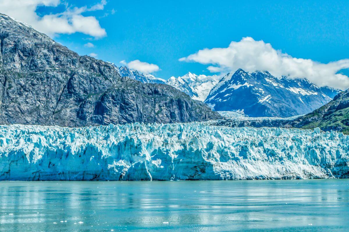
Alaska, the largest state in the United States, is truly a land of immense proportions.
With a total area spanning an astonishing 663,267 square miles, Alaska dwarfs even the vast state of Texas, measuring more than twice its size.
To put it into perspective, Alaska’s land area of 570,641 square miles alone is larger than all other states combined.
This rugged land is adorned with towering mountains, expansive glaciers, and abundant wildlife, making it a haven for adventure seekers and nature enthusiasts alike.
With 8 national parks, including the renowned Denali National Park, Alaska boasts some of the most pristine and untouched landscapes in the entire country.
Beyond its natural wonders, Alaska also boasts a rich cultural heritage and a vibrant capital city, Juneau.
This bustling hub offers a unique blend of urban amenities and access to the vast wilderness that surrounds it.
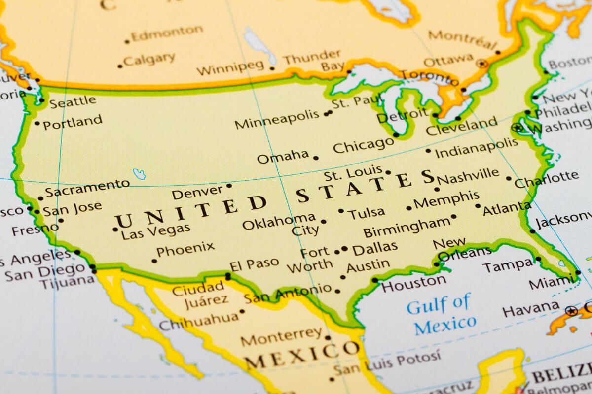
Top 2 Largest State – Texas

Coming in as the 2nd largest state in the country by land area, Texas is truly a force to be reckoned with.
Covering a total area of approximately 268,596 square miles, Texas is a behemoth of land mass. To put this into perspective, that’s larger than many countries around the world!
With a land area of 261,232 square miles, the Lone Star State stretches far and wide, showcasing its incredible size and scope.
Situated in the Gulf States region, Texas has unique geographical advantages and a diverse landscape that spans from its stunning coastline to its sprawling plains and mighty rivers.
This state truly embodies the spirit of “everything is bigger in Texas,” and exploring its vast expanse is a journey like no other.
With its vast land area, rich history, and undeniable charm, this Lone Star State is sure to leave a lasting impression on any traveler fortunate enough to venture within its borders.
Top 3 Largest State – California

California, the 3rd largest state by area, is undoubtedly a jewel in the US landscape. With a total area of 163,694 square miles, California offers an incredible range of geography to discover.
From the stunning Pacific coastline that stretches for miles, enticing surfers and beach lovers alike, to the majestic Sierra Nevada mountains, California’s landscape is a feast for the senses.
The contrast between sandy beaches and snow-capped peaks is truly awe-inspiring.
It’s no wonder that California is home to two of the most iconic cities in the world – Los Angeles and San Francisco.
The state’s tech industry, centered in Silicon Valley, is a global hub for technological advancements and startups.
The state is also renowned for its agricultural production, with fertile valleys and vineyards that produce an abundance of fresh produce and world-class wines.
Top 4 Largest State – Montana
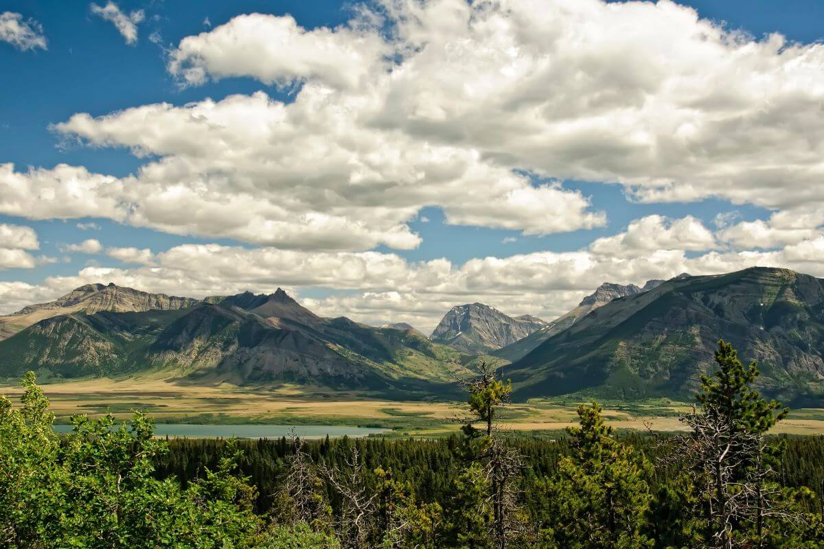
Montana stands tall as one of the most captivating destinations in the United States.
With an area of 147,040 square miles, Montana proudly claims its title as the 4th largest state in the country.
Known as Big Sky Country, this vast expanse of land is a playground for nature enthusiasts.
From the awe-inspiring wonders of Yellowstone National Park to the majestic peaks and pristine lakes of Glacier National Park, Montana offers an escape into the wilderness.
Montana’s land area spans 145,546 square miles, while its inland water area comprises 1,493 square miles.
But Montana’s allure extends beyond its natural wonders. The state thrives on key industries such as agriculture, forestry, and tourism.
Its fertile lands yield bountiful harvests and sustain a thriving agricultural community. The lush forests provide timber resources and support a robust forestry industry.
And with its stunning landscapes and outdoor recreational opportunities, Montana attracts tourists from around the world.
Top 5 Largest State – New Mexico
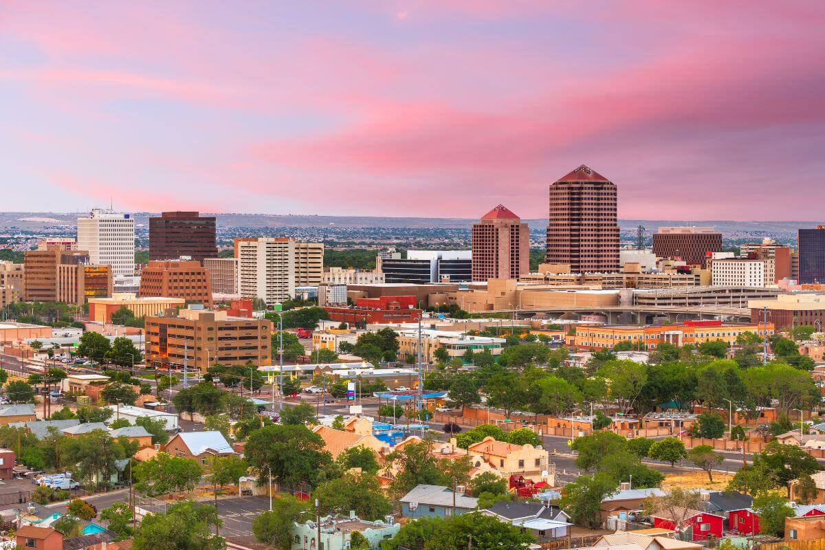
New Mexico is a hidden gem worth discovering. Ranked as the 5th largest state in the United States, it boasts a total area of 121,590 square miles.
The land area of New Mexico encompasses 121,298 square miles, spanning striking desert landscapes, towering mountains, and expansive plains.
It is a playground for adventurers and nature enthusiasts alike. But what sets New Mexico apart are its extraordinary national parks and monuments.
Explore the mysterious depths of Carlsbad Caverns National Park, where underground wonders await.
Immerse yourself in the ethereal beauty of White Sands National Monument, a breathtaking desert of rolling gypsum dunes.
With its diverse terrain and captivating attractions, it’s no wonder that New Mexico attracts visitors from across the globe.
Ranking US States by Land Area
One aspect that never fails to impress is the sheer size of each US state, with some covering more ground than entire countries.
To give you an idea of the scale, here is a table of US states ranked from the largest to the smallest by land area, including details of the total area and total inland water area:
| Rank | State | Total Area (sq. mi.) | Land Area (sq. mi.) | Total Inland Water Area (sq. mi.) |
| 1 | Alaska | 663,267 | 570,641 | 92,624 |
| 2 | Texas | 268,596 | 261,232 | 7,363 |
| 3 | California | 163,694 | 155,779 | 7,915 |
| 4 | Montana | 147,040 | 145,546 | 1,493 |
| 5 | New Mexico | 121,590 | 121,298 | 292 |
| 6 | Arizona | 113,990 | 113,594 | 396 |
| 7 | Nevada | 110,572 | 109,781 | 792 |
| 8 | Colorado | 104,094 | 103,641 | 454 |
| 9 | Oregon | 98,379 | 95,985 | 2,394 |
| 10 | Wyoming | 97,812 | 97,088 | 724 |
| 11 | Michigan | 96,713 | 56,528 | 40,185 |
| 12 | Minnesota | 86,935 | 79,607 | 7,328 |
| 13 | Utah | 84,897 | 82,191 | 2,706 |
| 14 | Idaho | 83,568 | 82,643 | 926 |
| 15 | Kansas | 82,278 | 81,762 | 516 |
| 16 | Nebraska | 77,349 | 76,825 | 524 |
| 17 | South Dakota | 77,116 | 75,811 | 1,305 |
| 18 | Washington | 71,298 | 66,449 | 4,849 |
| 19 | North Dakota | 70,698 | 69,001 | 1,697 |
| 20 | Oklahoma | 69,899 | 68,603 | 1,296 |
| 21 | Missouri | 69,702 | 68,716 | 987 |
| 22 | Florida | 65,758 | 53,603 | 12,154 |
| 23 | Wisconsin | 65,496 | 54,154 | 11,342 |
| 24 | Georgia | 59,425 | 57,501 | 1,924 |
| 25 | Illinois | 57,916 | 55,518 | 2,398 |
| 26 | Iowa | 56,273 | 55,858 | 415 |
| 27 | New York | 54,555 | 47,126 | 7,429 |
| 28 | North Carolina | 53,819 | 48,619 | 5,200 |
| 29 | Arkansas | 53,178 | 52,030 | 1,149 |
| 30 | Alabama | 52,420 | 50,644 | 1,776 |
| 31 | Louisiana | 51,988 | 43,199 | 8,789 |
| 32 | Mississippi | 48,432 | 46,920 | 1,512 |
| 33 | Pennsylvania | 46,055 | 44,739 | 1,316 |
| 34 | Ohio | 44,825 | 40,858 | 3,967 |
| 35 | Virginia | 42,775 | 39,493 | 3,282 |
| 36 | Tennessee | 42,144 | 41,235 | 910 |
| 37 | Kentucky | 40,411 | 39,492 | 919 |
| 38 | Indiana | 36,417 | 35,823 | 594 |
| 39 | Maine | 35,384 | 30,841 | 4,543 |
| 40 | South Carolina | 32,021 | 30,070 | 1,951 |
| 41 | West Virginia | 24,230 | 24,038 | 192 |
| 42 | Maryland | 12,406 | 9,705 | 2,700 |
| 43 | Hawaii | 10,926 | 6,428 | 4,499 |
| 44 | Massachusetts | 10,554 | 7,801 | 2,754 |
| 45 | Vermont | 9,616 | 9,217 | 400 |
| 46 | New Hampshire | 9,348 | 8,952 | 396 |
| 47 | New Jersey | 8,723 | 7,354 | 1,369 |
| 48 | Connecticut | 5,544 | 4,840 | 703 |
| 49 | Delaware | 2,489 | 1,949 | 539 |
| 50 | Rhode Island | 1,545 | 1,034 | 511 |
Largest State in the US Final Thoughts
When considering the vastness of the United States, Montana holds a significant place in the pantheon of states.
While it may not claim the title of the largest state and that distinction falls to the mighty Alaska, there is still much to marvel at in Montana’s expansive land area.
Montana ranks 4th in size, spanning 147,040 square miles, impressively substantial despite not matching Alaska’s colossal 663,267 sq. mi.
What sets Montana apart is not just its size, but the captivating beauty and diversity within its borders.
From the majesty of Glacier National Park to the geothermal wonders of Yellowstone National Park, Montana’s landscapes are the stuff of dreams.
It is a state that embodies the spirit of the great American West, with its rugged peaks, pristine lakes, and endless skies.
So, while Montana may not claim the crown as the largest state, it remains a powerful contender in the league of grandeur.
Montana’s magnificent landscapes and natural wonders continue to captivate travelers from far and wide, offering a taste of untamed beauty that cannot be measured solely by square mileage.
Largest State in the US FAQs
1. What State Holds the Title of the Largest in the United States?
Alaska holds the title of the largest state in the United States. It spans over 663,267 square miles, making it the largest in terms of total area.
2. Can You Identify the Smallest State in the United States?
Yes. The smallest state in the United States is Rhode Island. It has an area of approximately 1,545 square miles, making it the smallest state in terms of land area.
3. Does Montana Stand as the Third-Largest State?
No. Montana does not stand as the 3rd largest state. Montana is actually the 4th largest state in the United States by land area.
The 3 largest states are Alaska, Texas, and California, in that order.
4. Which City Is the Largest in the United States?
Sitka, Alaska, is the city in the United States with the largest land area, with approximately 4,811.5 square miles.
In terms of population, the largest city in the United States is New York City, located in the state of New York.
If you’re interested in diving deeper into Montana, stay involved with these articles:
- https://cybercemetery.unt.edu/archive/statab/20110707015745/http://www.census.gov/compendia/statab/2011/tables/11s0355.pdf
- https://uk.usembassy.gov/states-of-the-union-states-of-the-u-s/#
- https://laborstats.alaska.gov/trends/jan91art1.pdf
- https://www.census.gov/library/stories/2021/04/2020-census-data-release.html
- https://www.alaska.gov/kids/learn/population.htm