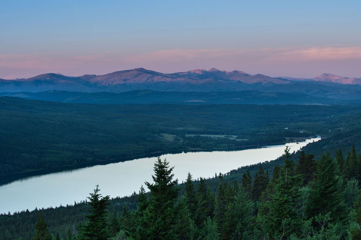
I gaze out at the majestic peaks, feeling the crisp mountain air as it fills my lungs. Montana is a treasure trove of natural beauty, where the elevation tells stories of breathtaking landscapes and adventures.
If you’ve ever wondered about the altitude of Montana or how the Rocky Mountains shape the state’s topography, you’re in the right place.
We’ll dive into the various mountain ranges that grace this majestic land, including the iconic peaks of Yellowstone National Park and Glacier National Park.
But it’s not just about the mountains. Montana’s altitude reveals a tapestry of diversity, from broad valleys with their expansive beauty to the depths of canyons that carve through the earth.
Whether you’re planning a summer getaway or embarking on a scenic road trip, understanding Montana’s heights will enhance your journey and leave you in awe of nature’s grand design.
- Related article: Montana’s Coordinates
Get ready to be captivated by the beauty that lies at every turn, and let the Montana elevation take your breath away.
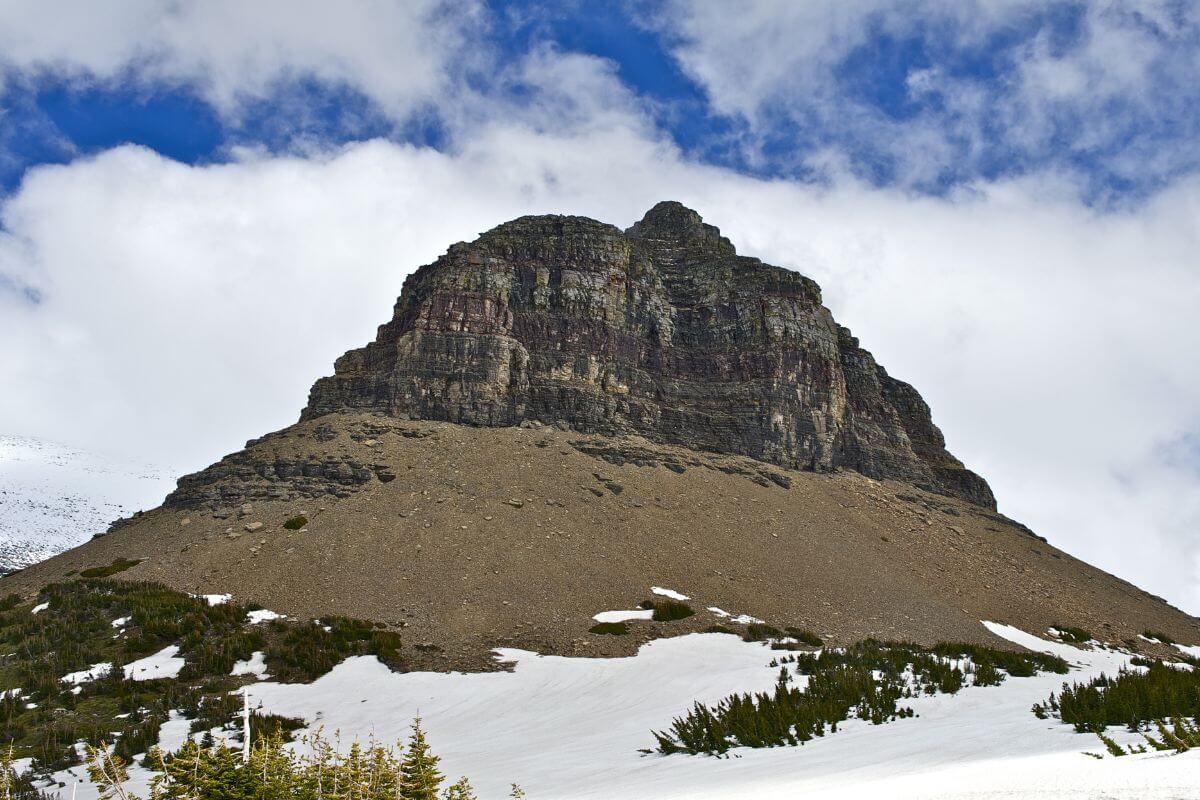
Montana Highest Peak: Top 10
Montana’s highest peaks are a testament to the grandeur of nature’s creations. These towering giants reach for the sky, offering breathtaking vistas and challenging adventures for those who dare to explore.
Each peak has its own unique allure, beckoning adventurers to discover their untamed beauty.
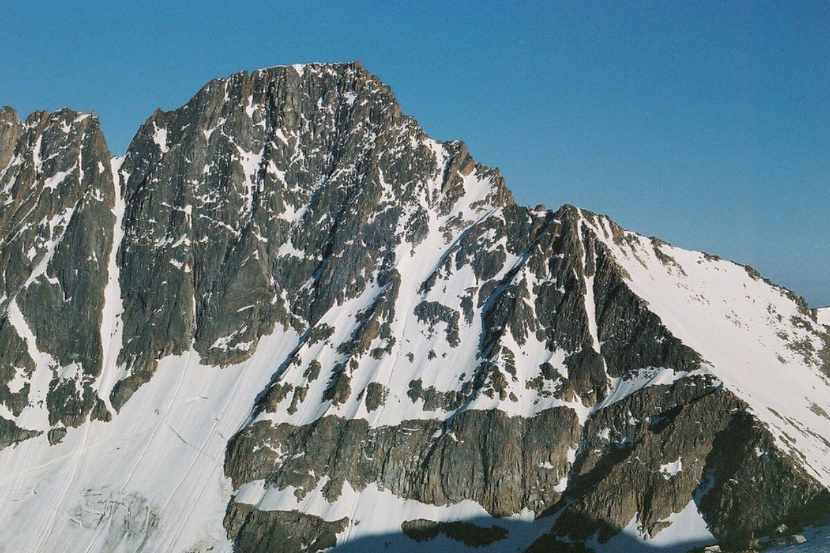
- Granite Peak – Granite Peak stands tall at the highest altitude in Montana, reaching a staggering 12,799 feet elevation. Located in Park County, this magnificent peak showcases the rugged beauty of the Absaroka-Beartooth Wilderness.
- Mount Wood – Mount Wood claims the second spot on our list, soaring to a height of 12,649 feet in Stillwater County. Its pristine wilderness setting and jaw-dropping views make it a favorite among outdoor enthusiasts.
- Castle Mountain – Castle Mountain takes the third position, reaching a height of 12,612 feet in Carbon County. With its dramatic slopes and majestic presence, it offers an unforgettable mountaineering experience.
- Whitetail Peak – Whitetail Peak follows closely, standing proud at 12,551 feet. Its location in Lincoln County adds to its allure, surrounded by the breathtaking scenery of the Northern Rockies.
- Castle Rock Spire – Castle Rock Spire reaching an impressive 12,540 feet, captivates climbers and hikers alike. This towering rock formation in Beaverhead County offers a thrilling adventure for those seeking a challenge.
- Silver Run Peak – Silver Run Peak standing at 12,500 feet, showcases the rugged beauty of the western Montana skyline. Located in Gallatin County, it offers unparalleled views of the surrounding wilderness.
- Tempest Mountain – With its altitude of 12,469 feet, visitors are in awe of its majestic presence. Situated in Park County, it is a hidden gem waiting to be discovered.
- Mount Peal – Mount Peal standing tall at 12,409 feet, is a testament to the ruggedness and raw beauty of Montana’s mountainous landscapes. It is located in Park County, offering breathtaking views from its summit.
- Castle Rock Mountain – Castle Rock Mountain with its altitude of 12,408 feet, is a paradise for climbers and hikers. Located in Park County, it provides an exhilarating ascent and rewards adventurers with stunning panoramic views.
- Beartooth Mountain – Beartooth Mountain rounds out our list at 12,351 feet. Its soaring peaks and jaw-dropping vistas capture the essence of Montana’s wild and untamed spirit.
Montana Lowest Point: Kootenai River
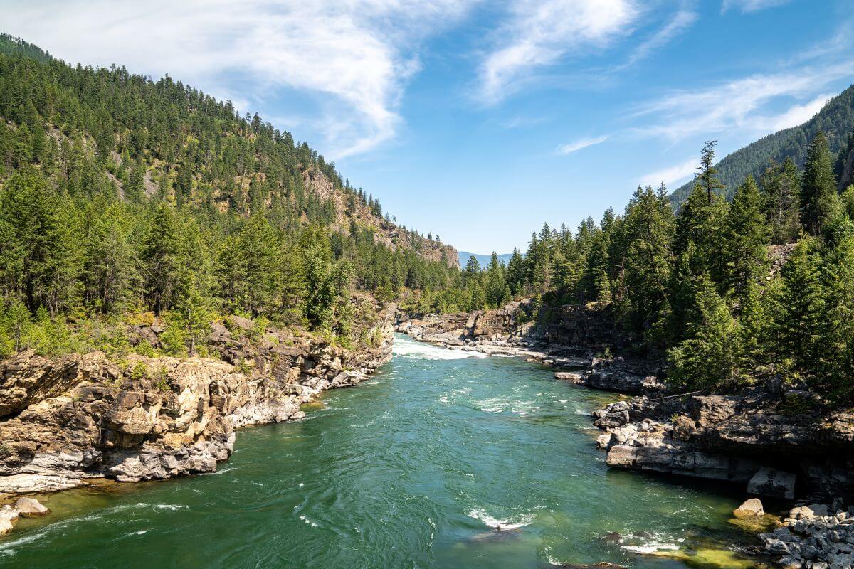
The Kootenai River, winding its way through Montana and into Canada, is a natural wonder that unfolds before your eyes.
As the lowest point in Montana, the Kootenai River sits at a modest elevation of 1,800 feet (549 m) above sea level, offering a striking contrast to the towering peaks that dominate the state’s landscape.
Stretching across 485 miles, the Kootenai River is one of the few rivers in the United States that flows north into Canada.
Kootenai River’s gentle currents and tranquil waters make it a haven for recreational activities such as boating and fishing. Imagine casting your line into the river’s depths, feeling the thrilling tug of a fish as you reel it in.
Montana rivers, such as the Missouri, Yellowstone, Clark Fork, and Kootenai, offer breathtaking landscapes and diverse recreational activities, attracting adventurers and nature enthusiasts from all over the world.
Montana Cities and Towns: Elevation Overview
Montana is home to diverse cities and towns nestled in its vast wilderness, each offering unique charm and allure.
From Yellowstone National Park to the Rocky Mountains, the state’s destinations showcase majestic beauty. What sets them apart is the varying altitude, from mountains to valleys.
Exploring Missoula’s vibrant streets or Glacier National Park’s wilderness, you’ll be enchanted by Montana’s mystique. Prepare to be captivated by the heights and depths of this captivating state.
Montana’s Highest Elevation: Cities and Town
Here are the top 10 highest-altitude towns and cities. These are estimated by the U.S. Geological Survey. Altitudes from this data set may be off by as much as 125 feet.
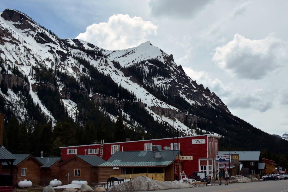
- Cooke City – Located in Park County, Cooke City stands at an elevation of 7,608 feet. This city offers stunning views of the Rocky Mountains and is a hub for outdoor activities.
- Silver Gate – Situated in Park County as well, Silver Gate is a charming mountain town with an elevation of 7,593 feet. Visitors can enjoy tranquil surroundings and awe-inspiring mountain vistas.
- Big Sky Mountain Village – Found in Madison County, Big Sky Mountain Village is elevated at 7,491 feet. This village is a popular destination for skiing, hiking, and other mountain adventures.
- Monida – Monida is located in Beaverhead County and sits at an elevation of 6,794 feet. It is known for its serene landscapes and attracts nature lovers and outdoor enthusiasts.
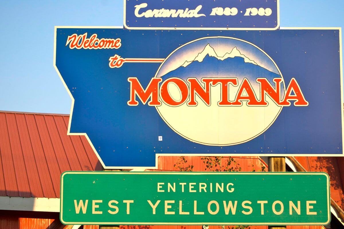
- West Yellowstone – Located in Gallatin County, West Yellowstone is one of Montana’s highest-elevation cities at 6,712 feet. It serves as a gateway to Yellowstone National Park, offering access to natural wonders and wildlife encounters.
- Lakeview – Situated in Beaverhead County, Lakeview has an elevation of 6,705 feet. Visitors can enjoy panoramic views of the lake and surrounding mountains, providing a picturesque setting for relaxation and outdoor recreation.
- Georgetown – Found in Deer Lodge, Georgetown is a quaint town nestled in the Montana Rockies at an elevation of 6,578 feet. It offers rustic charm and splendid mountain vistas, making it a peaceful retreat.
- Jardine – Located in Park County, Jardine is situated at 6,559 feet. This town captures the essence of a small mountain community and provides a majestic backdrop for nature enthusiasts.
- Jackson – Situated in Beaverhead County, Jackson is a remote town with an elevation of 6,548 feet. Surrounded by rugged beauty, it offers an escape from the hustle and bustle of daily life and an opportunity to immerse oneself in nature.
- Elkhorn – Elkhorn is found in Jefferson County and stands at an elevation of 6,512 feet. With breathtaking views of the surrounding peaks and valleys, it offers residents and visitors a peaceful mountain retreat and access to outdoor adventures.
Montana’s Lowest Elevation: Cities and Town
Montana, known for its majestic mountain ranges and breathtaking landscapes, is also home to cities and towns that boast the state’s lowest altitude.
According to data from the U.S. Geological Survey’s Geographic Names Information System, here are the top 10 towns and cities in Montana with the lowest heights:
- Culbertson – Located in Roosevelt County, Culbertson sits at an elevation of 1,919 feet. This town offers a picturesque setting with rolling hills and beautiful prairie landscapes.
- Slab Crossing – Situated in Roosevelt County as well, Slab Crossing is a quaint village perched at an elevation of 1,923 feet. Visitors can revel in the peaceful ambiance and enjoy the scenic views of the surrounding countryside.
- Nohly – Found in Richland County, Nohly boasts an elevation of 1,936 feet. This charming town is known for its friendly community and offers a serene atmosphere amidst picturesque plains and distant mountain ranges.
- Medicine Lake – Situated in Sheridan County, Medicine Lake is a scenic town with an elevation of 1,942 feet. The town takes its name from the beautiful lake nearby, offering residents and visitors a tranquil retreat amidst nature’s splendor.
- Reserve – Located in Sheridan County as well, Reserve stands at an elevation of 1,948 feet. True to its name, this town provides a peaceful and secluded environment, making it an ideal destination for those seeking refuge from the hustle and bustle of city life.
- Homestead – Found in Sheridan County, Homestead is a cozy town nestled at an elevation of 1,949 feet. With its idyllic countryside setting and friendly atmosphere, Homestead offers a perfect escape for nature enthusiasts and those looking for a slower pace of life.
- Fairview – Situated in Richland County, Fairview enjoys an elevation of 1,959 feet. This town is known for its welcoming community and is surrounded by picturesque farmlands and rolling hills, providing a quintessential Montana rural experience.
- Sidney – Located in Richland County as well, Sidney is a vibrant town with an elevation of 1,967 feet. As the county seat, Sidney offers a wide range of amenities, cultural attractions, and a bustling downtown area, making it a hub of activity in the region.
- Fort Kipp – Found in Roosevelt County, Fort Kipp stands at an elevation of 1,976 feet. This historic town holds significance as a former trading post and is now a peaceful community where residents and visitors can immerse themselves in the rich local heritage.
- Crane – Situated in Richland County, Crane is a charming town perched at an elevation of 1,981 feet. With its serene surroundings and friendly atmosphere, Crane offers a tranquil retreat for outdoor enthusiasts and those seeking a close-knit community.
Explore the area’s stunning vistas and recharge amidst the natural wonders of this town.
Note that altitudes from this data set may be off by as much as 125 feet and that some towns may cover areas with a greater range of heights.
Montana Elevation Final Thoughts
Montana’s peaks, rivers, and towns reveal its diverse landscapes. Granite Peak, Mount Wood, and Castle Mountain showcase rugged beauty and untamed spirit.
These peaks entice climbers with dramatic slopes and breathtaking vistas. In contrast, the tranquil Kootenai River is Montana’s lowest point, offering a peaceful escape for boating and fishing.
Cities like Cooke City and Missoula, and towns like Culbertson and Nohly, reflect the state’s diverse topography.
Montana’s range of elevations adds mystique and immerses visitors in natural wonders, from Glacier National Park to charming towns.
Explore and witness nature’s grandeur at Montana’s highest and lowest points.
Montana Elevation FAQs
1. What Are the Elevations of Montana’s Major Cities and Towns?
Montana’s major cities and towns with their altitudes are the following:
- Helena at 4,068 feet
- Billings at 3,153 feet
- Missoula at 3,232 feet
- Butte at 5,539 feet
- Bozeman at 4,806 feet
- Kalispell 2,984 at feet
- Anaconda at 5,239 feet
- Great Falls at 3,398 feet
- Montana City at 4,199 feet
2. What Is the Lowest Altitude in Montana?
At the Montana-Idaho border, in the northwest part of the state, lies the lowest point of Montana. This is where the Kootenai River exits the state, with an altitude of 1,800 feet above sea level.
3. What Is the Highest Elevation Above Sea Level in Montana?
Granite Peak stands at the highest altitude above sea level in the state. With an impressive height of 12,799 feet, this majestic peak offers breathtaking panoramic views of the rugged landscapes that surround it.
4. Is Montana Considered a High-Altitude Region?
Yes, Montana is considered a high-altitude region due to its varying heights and numerous mountain ranges. The state is home to peaks exceeding 10,000 feet, with Granite Peak standing as the highest point.
5. What Is the Difference Between High Altitude and Elevation?
The elevation is the measurement of how high the land surface is compared to a reference point like NGVD (National Geodetic Vertical Datum) or another vertical datum.
It tells us the height of the land surface above a specific reference level. While high altitude means any elevation over 1,219 meters (4,000 feet).
If you’re interested in diving deeper into Montana, stay involved with these articles:
- Understanding Montana’s Northwest Aspect
- Montana’s Location on the West Coast
- Montana’s Adjacent States
- Montana’s Environmental Zones
- https://msl.mt.gov/geoinfo/geography/geography_facts/montanaxs_300_tallest_peaks
- https://www.usgs.gov/educational-resources/highest-and-lowest-elevations
- https://floodmaps.fema.gov/tutorials/check-ras/0.3_glossary.shtml
- https://www.law.cornell.edu/definitions/index.php?width=840&height=800&iframe=true&def_id=2cf9863f85f2f25b6e5e0a2e9dacfe7b&term_occur=999&term_src=Title:40:Chapter:I:Subchapter:C:Part:86:Subpart:S:86.1864-10
- https://msl.mt.gov/geoinfo/geography/geography_facts/elevation_of_montana_cities
- https://commons.wikimedia.org/wiki/File:Granite_Peak_Montana_2.jpg