Would you like to embark on a captivating journey into the realm of Montana earthquakes? The state is brimming with seismic hotspots that are sure to attract your curiosity and leave you awe-inspired by their power.
In this article, we will explore significant historic earthquakes that have influenced the development of Montana and examine their profound effects on the landscape and its inhabitants.
Our years of extensive research on the subject ensure that you can rely on us to guide you expertly through the Montana earthquake-prone areas.
- Related article: When Montana Became a State
Whether you’ve come as an inquisitive tourist, a thrill-seeking adventurer, or an earthquake enthusiast hungry for knowledge, we’ve got you covered.
Earthquakes may be powerful and a bit scary, but knowledge is the key to staying prepared.
Ready to shake things up? Let’s begin.
Montana’s Overall Seismic Activity
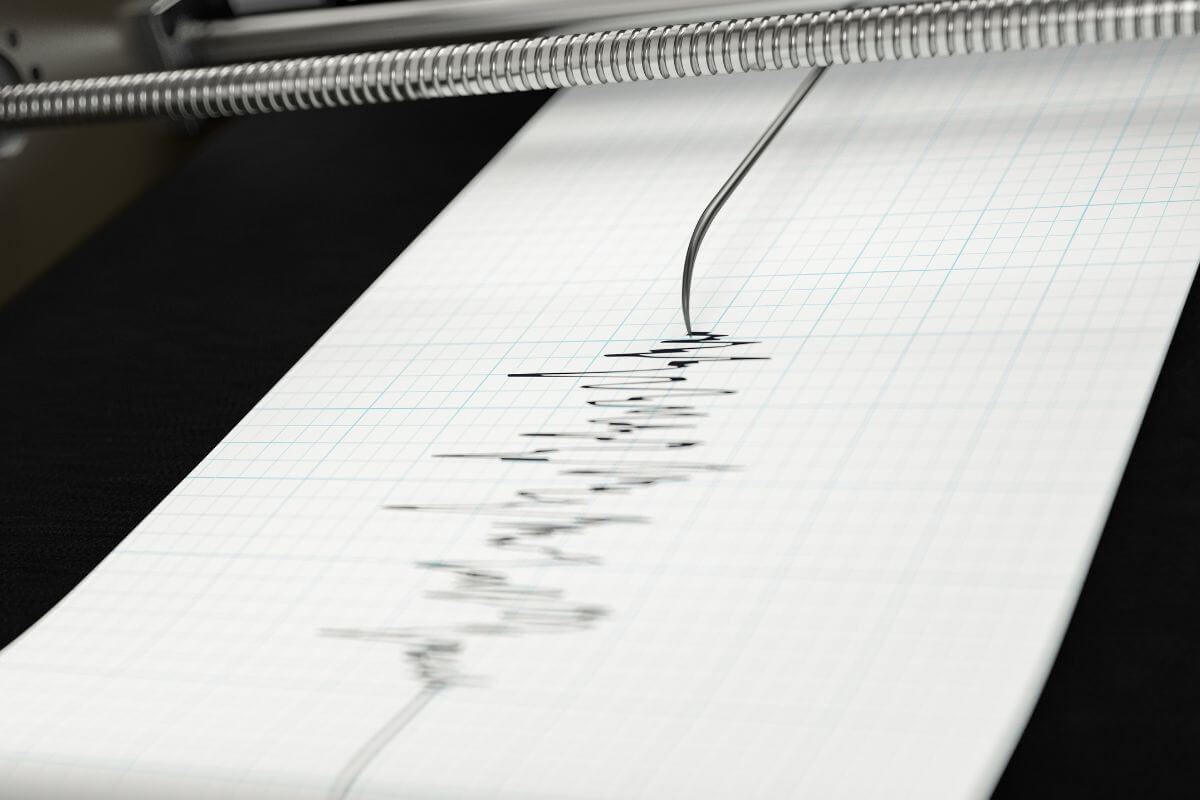
Montana, nestled in the breathtaking western United States, is no stranger to earthquake activity.
Montana lies within the Intermountain Seismic Belt—a tectonically active region or earthquake hazard zone where unexpected tremors happen more than usual.
Seismic activity can crack gas pipes and damage power lines, electrical wiring, and appliances, potentially triggering fires. Montana has a history of both earthquake and fire incidents.
- Read more about Montana’s Fire History
One of Montana’s most memorable seismic events took place near the picturesque Hebgen Lake on August 17, 1959.
A powerful 7.3 earthquake struck the region, inflicting substantial damage and, regrettably, fatalities. It served as a sobering reminder of Mother Nature’s devastating power.
Now, on to the famous West Yellowstone. This iconic region, which includes parts of the world-famous Yellowstone National Park, is known for its volcanic and seismic antics.
Nestled atop a defiant supervolcano, the area experiences a dance of frequent, albeit small, earthquakes.
That said, there is no need to live in constant fear. Despite Montana’s vibrant earthquake history, the majority of the state’s annual quakes go unnoticed by the public.
These tremors, often on the smaller side, hum in the background like a secret melody, reminding us that the Earth is alive and ever-changing.
To delve deeper into Montana’s seismic wonders, the Montana Bureau of Mines and Geology (MBMG) is your go-to source. They diligently monitor earthquakes, keeping us informed with resources and data.
From earthquake patterns, locations, magnitudes, and depths to earthquake geology terms and earthquake statistics, they’re armed with the knowledge we need to navigate this wild, seismic landscape.
Major Montana Earthquakes
Let us take you on a journey through Montana’s seismic history, where the Earth shook and stirred, leaving its mark on this wild, captivating landscape.
Come along as we visit the remnants of Montana’s turbulent past, where nature’s mighty hand has left its mark for all to see.
Clarkston Valley Earthquake
On that fateful day, October 18, 1925, the ground beneath the quiet town of Clarkston in Montana trembled.
One of the largest historic earthquakes recorded in Montana, the Clarkston Valley Earthquake furiously shook the land at an estimated magnitude of 6.6 on the Richter scale.
Earthquake shocks were felt far across the state, including outside of it in regions of Idaho and Washington.
In the wake of this powerful quake, buildings succumbed to its raw strength, bearing the weight of extensive damage. Infrastructure, bridges, and roads were marred, crippled by the unforgiving nature of geological forces at play.
The earthquake unleashed a series of landslides, adding to the destruction and further blocking roadways. As if scars were etched onto the land, ground fissures and surface faulting served as haunting reminders of the tremendous power harnessed within the depths of the earth.
Yet amid the chaos and wreckage left by the Clarkston Valley Earthquake, one remarkable fact emerged: there were no reported fatalities.
Lives were miraculously spared, and the casualties were limited to the property damage and the hearts that bled for the irreplaceable losses.
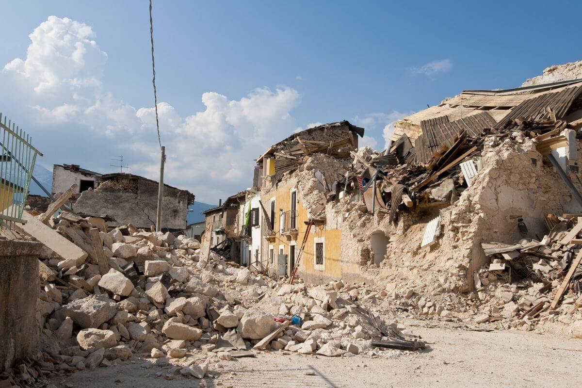
Helena Earthquake
On April 18, 1935, an event of seismic proportions unfolded near the charming city of Helena in Montana, United States.
The Helena Earthquake of 1935, was estimated to have had a Richter scale value of 6.2 and was felt across regions of Montana, Wyoming, and Idaho.
The Helena Earthquake of 1935 left a path of devastation in its wake. It was followed by several aftershocks, exacerbating the overall impact.
Ground ruptures, landslides, and other geological disturbances carved their marks in the landscape, serving as chilling reminders of the raw power unleashed that day.
The city of Helena and its surroundings bore the brunt of this tempestuous quake. Buildings and infrastructure fell victim to its unmerciful force, resulting in two reported fatalities and numerous injuries.
The Helena Earthquake resulted in property damage amounting to an estimated $3 million at the time, which would translate to over $66 million in today’s money.
The 1935 Helena Earthquake served as a wake-up call, highlighting the high-hazard seismic zones in the region. It sparked a renewed awareness of earthquake risks and the need for preparedness.
The event emphasized the importance of understanding liquefaction and the potential dangers associated with such natural disasters.
Though the 1935 Helena Earthquake left behind scars and heartache, it also ushered in a new era of preparedness in the face of seismic threats. With the lessons learned from this historic event, Montana continues to strive toward minimizing the risks posed by future earthquakes.
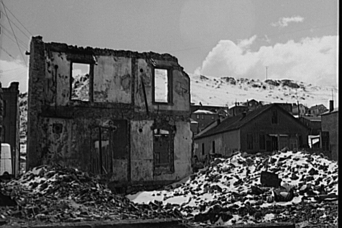
Hebgen Lake Earthquake
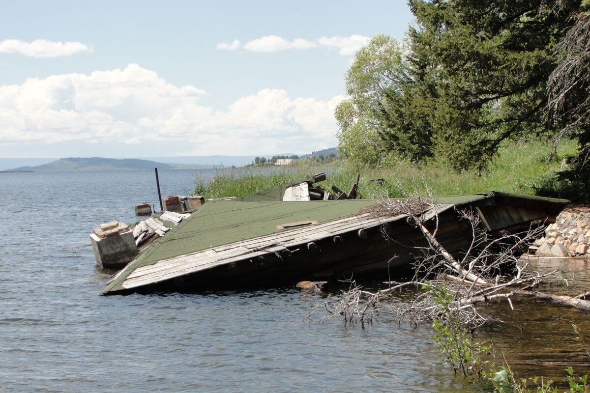
On the fateful day of August 17, 1959, a destructive force of nature unleashed its fury near Hebgen Lake in southwestern Montana.
The largest earthquake ever to hit the state of Montana, The Hebgen Lake Earthquake tore through the land at a magnitude of 7.3 on the Richter scale.
The seismic behemoth’s unbridled power generated a humongous wave that overtopped Hebgen Dam and resulted in a massive landslide.
The Hebgen Earthquake holds the distinction as the 14th biggest earthquake ever recorded in the United States and was strong enough to be felt across an extensive area, including in regions of Canada, North Dakota, and Washington.
In its wake, it left severely damaged infrastructure, including roads, bridges, and buildings in and around Hebgen Lake.
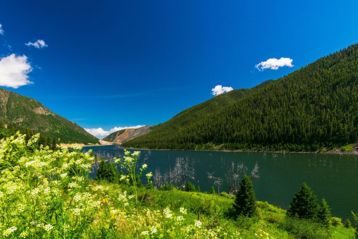
The devastating event triggered the massive Madison Canyon landslide responsible for forming the now-famous Quake Lake or Earthquake Lake.
As if that wasn’t enough, the earthquake’s estimated total damages soared to a stunning $11 million, or $116 million in modern currency.
The Hebgen Lake Earthquake took 28 lives and dealt unbearable trauma and heartache to affected communities.
The Hebgen Lake Earthquake remains etched in Montana’s history as one of the most destructive earthquakes to ever rock the state. Its magnitude and destruction—are all etched into the archives of seismic infamy.
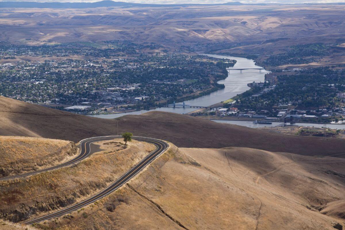
Dillon Earthquake
The heart of Montana was shaken by an earthquake that occurred one tragic day on July 25, 2005.
The Dillon Earthquake registered at a 5.6 on the Richter scale, making it the biggest earthquake the state had experienced in 45 years.
This earthquake was even more unexpected because it occurred in a previously unknown fault that had no visible signs on the surface.
Despite its seemingly modest rating on the Richter scale, this earthquake did not mess around. It rocked western Montana and rattled the nerves of folks in Idaho and northwestern Wyoming too.
The main shock was followed by hundreds of aftershocks after the earthquake, which were recorded by the Montana Regional Seismograph Network.
From reports of crumbling buildings to toppled-over chimneys, the quake left its fair share of destruction in its wake. On the upside, there were no reports of fatalities or injuries.
The University of Montana Western’s Old Main Hall and the Mary Innes school were among the buildings that bore the wrath of the Dillon Earthquake.
The good news is that this earthquake event emphasized the need for better warning systems and evacuation procedures and stimulated significant scientific study. It served as a sharp warning about the force of nature and a wake-up call for the area.
Lincoln Earthquake
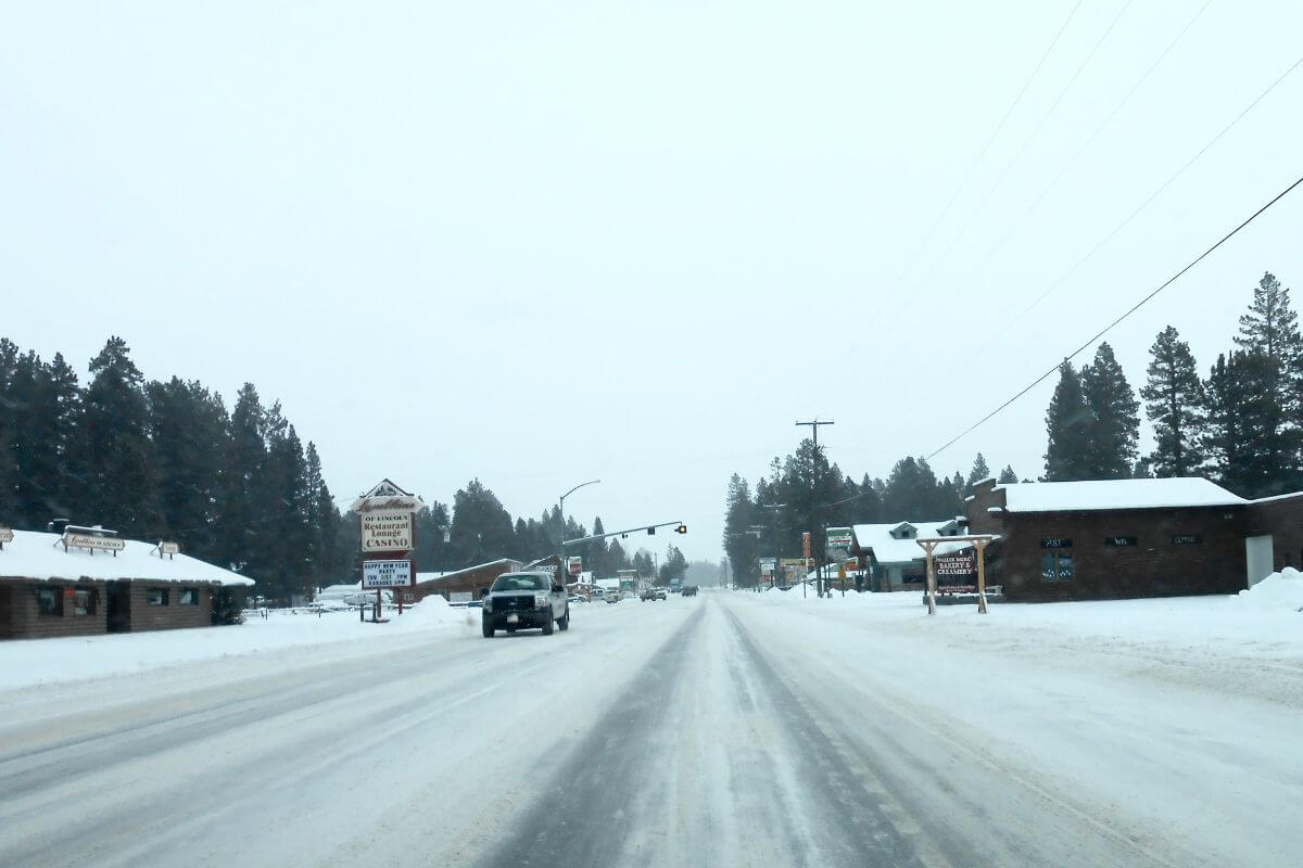
A seismic event shook the Montana town of Lincoln on July 6, 2017. The Lincoln earthquake came at the community with a force of 5.8 on the Richter scale.
This earthquake left a lasting impression across the state and was even felt as far as parts of Wyoming, Idaho, and Canada.
That said, the effects of the earthquake were comparatively less severe. There were no fatalities or serious injuries, and the majority of reported injuries were minor.
Assessing Montana’s Earthquake Readiness

The state of Montana has taken strong action to increase its seismic resilience after realizing the need to be prepared for earthquakes.
The measures that various regions take to safeguard their citizens from potential disasters are fascinating.
Leading the charge, the Montana Department of Emergency Services (MTDES) is in charge of organizing and carrying out the state’s disaster preparedness plans for earthquakes and other calamities.
MT DES is structurally located within the administrative framework of the Montana Department of Military Affairs.
- Read more about Military Facilities in Montana
Montana boasts comprehensive emergency response plans and protocols that guide actions before, during, and after an earthquake.
The state actively promotes public awareness and education programs to inform residents about earthquake risks and preparedness strategies.
In order to evaluate their emergency response capabilities and pinpoint areas for development, they also regularly perform drills and exercises.
Montana collaborates with federal organizations like the Federal Emergency Management Agency (FEMA) and the United States Geological Survey (USGS) to improve earthquake monitoring.
Furthermore, Montana adopts and enforces building codes that incorporate seismic design and construction standards, minimizing potential damage caused by earthquakes.
One noteworthy campaign organized annually by MTDES is ShakeOut Montana, which aims to increase earthquake readiness among residents, schools, and organizations.
This campaign encourages active participation in earthquake drills and emphasizes the importance of preparedness activities.
With its proactive approach to earthquake readiness, Montana is setting a commendable example for other regions.
Montana Earthquakes Final Thoughts
Montana has faced its fair share of powerful earthquakes throughout its history.
From the devastating Clarkston Valley Earthquake of 1925 to the more recent Lincoln earthquake of 2017, Montanans are no strangers to the raw force that Mother Nature is capable of inflicting.
Instead of losing hope, however, communities draw strength and knowledge from these seismic events, using them to shape the state’s approach to earthquake preparedness and mitigation.
With each earthquake, Montana has learned valuable lessons and implemented safety protocols to better protect its residents.
By staying prepared and proactive, Montanans mitigate the impact of earthquakes and ensure the safety of their communities.
Montana Earthquakes FAQs
1. How Common Are Earthquakes in Montana?
Montana is no stranger to seismic events, particularly in its western region. An estimation by the United States Geological Survey (USGS) puts Montana at a range of 25-30 earthquakes per year big enough to be felt by residents.
The daily count is at 7-10 earthquakes, but nearly all of those go undetected because of their small size.
2. Is Montana on a Fault Line?
Numerous active faults run across the state of Montana, among the more notable ones being the Lewis and Clark Fault Zone.
Additionally, Montana is located within the Intermountain Seismic Belt, an area ripe with seismic activities.
3. What Was The Strongest Quake In Montana?
The Hebgen Lake Earthquake of 1959, which occurred on August 17, 1959, had a magnitude of 7.5 and was the biggest earthquake ever recorded in Montana.
It claimed 28 lives and left behind a trail of destruction and geological transformations, including the now-famous Quake Lake.
4. Is Montana Prone to Natural Disasters?
Montana is moderately prone to natural disasters due to its climate and varied topography.
It is particularly susceptible to earthquakes due to its location within the Intermountain Seismic Belt. For this reason, the state puts particular emphasis on natural disaster preparedness and mitigation to reduce the severity of these natural disasters.
5. What Was the Biggest Natural Disaster in Montana?
One event that stands out is the 1910 Big Burn, often considered the state’s biggest natural disaster. It broke out in August 1910, destroying millions of acres of land and leaving the gravest devastation in its wake.
According to the Montana Historical Society, the fire took the lives of 87 people, leaving an indelible mark on affected communities and the state’s history.
For a deeper dive into the world of Montana, enrich your mind with these stellar reads:
- Montana’s Gold Rush Legacy
- Last Montana Presidential Tour
- The Cuisine of Montana
- Montana’s History Highlights
- Montana Launch Pads
- https://www.montana.edu/emergency/emergency_actions/earthquake.html
- https://www.usgs.gov/news/60-years-1959-m73-hebgen-lake-earthquake-its-history-and-effects-yellowstone-region
- https://www.fs.usda.gov/detail/custergallatin/home/?cid=FSEPRD891034
- https://www.usgs.gov/news/featured-story/magnitude-58-earthquake-montana
- https://serc.carleton.edu/files/earthscoperockies/stickneyposter_1129844125.pdf
- https://picryl.com/media/helena-montana-demolition-of-buildings-damaged-in-1935-earthquakes
- https://commons.wikimedia.org/wiki/File:Hebgen_Lake_House
- https://commons.wikimedia.org/wiki/File:Dillon,_Montana
- https://commons.wikimedia.org/wiki/File:Lincoln,_Montana